October 2014
|
October 2014 // Volume 52 // Number 5 // Ideas at Work // v52-5iw2


Crowdsourcing Rural Data Collection
Abstract
The rise of geospatial information on popular websites and its comparative lack in rural areas prompted the pilot project described here to apply crowdsourcing techniques to community mapping. The 3-month project yielded many valuable lessons to apply to future endeavors, but did not yield enough point-of-interest (POI) data to merit an analysis of its accuracy. Results were disappointing in that few POIs were collected, despite participants' initial enthusiasm and hours of training. Key questions for the future are the following. Is it feasible to sustain volunteer-based community mapping efforts in rural areas? And, if so, what kind of incentives should be offered?
Introduction
Tremendous amounts of place-based data, images, and other geographically relevant information are available on Web-based platforms because the "Web 2.0" movement has made it easy to geo-reference and share information (O'Reilly, 2005). Private citizens with few formal qualifications are often in the best position to provide geographic information that requires intimate and current knowledge of local conditions (Bruns, 2008; Fischer, 2000; Flanigan & Metzger, 2008; Goodchild, 2007).
While crowdsource-based applications such as Google Maps and Wikipedia have leveraged a global body of volunteers (Finocchiaro, 2010; Tapscott & Williams, 2008) to generate data for their products, there is significantly less data on these sites for rural areas compared with metropolitan areas. Consequently, we wanted to explore the use of crowdsourcing principles in generating geospatial data in rural communities. Similar to other Extension crowdsourcing projects (Johnson, McGee, Campbell, & Hays, 2013; McGee & Kirwan, 2010; Merry, Bettinger, & Hubbard, 2008), we also sought to increase participants' geospatial literacy to increase the number of rural community assets listed online.
Extension's Role
University of Minnesota Extension undertook a pilot project to train participants to collect point-of-interest (POI) data in two rural counties (Crow Wing and Douglas). A POI is a specific location that someone may find useful or interesting. POI data refers to the geographic coordinates (latitude and longitude) and qualitative description of that POI. We planned to assess the types of POIs collected by volunteers and measure the accuracy of data. We partnered with a private company, Navteq, which helped fund the project and provided technical assistance, as well as valuable information on how companies make digital maps.
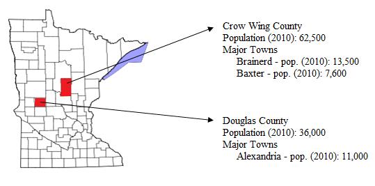
We selected Crow Wing and Douglas counties (Figure 1) for this pilot because of their prior experience with Extension programming, relatively large populations compared with other rural Minnesota counties, and status as tourism hubs, as well as Navteq's desire to address customers' desire for more tourism-related POIs.
Figure 1.
Location and Data on Crow Wing and Douglas Counties
Recruitment efforts focused on enlisting volunteers from civic-minded organizations. We were encouraged by the enthusiasm shown at our presentations on the uses and importance of community mapping for promoting tourism and other local businesses and services, yet we managed to recruit only 10 people from each county. Participants in each county underwent 6 hours of face-to-face training in Summer 2010. The training objectives were to:
- Introduce participants to key concepts related to location-based services.
- Facilitate discussion to help determine high-priority locations and what category of POIs participants should focus on collecting.
- Teach volunteers how to gather, add, and edit accurate data on Navteq and Google Maps.
- Form teams to continuously collect and edit data after training had commenced.
What Did We Learn?
Following our training, we found:
- A total of 40 POIs were collected.
- A total of 12 out of 20 participants ended up collecting data.
- Two participants collected more than 10 points of interest.
After 3 months of work, this reflected disappointing outcomes. Was the primary incentive of spillover benefits to participants' communities sufficient? We also offered free Extension programming to the communities of participants who mapped the most POIs.
Other questions included: Was there sufficient periodic follow-up from Extension staff with participants? Were all necessary skills taught to participants? Similar to Akin, Shaw, Stepenuck, and Goers (2013), we asked if participants felt the work was worth their effort and time, or whether they had conflicting priorities.
We posed these questions in an online end-of-program survey and individual interviews. First we asked participants about level of difficulty. The task participants found the hardest was "Finding time to map POIs," which had a mean of 4.3 on a scale of 1 to 6. Other mapping activities were relatively easy to accomplish (Table 1).
| Please rate the level of difficulty in each of the following activities, with 6 = rocket science and 1= no brainer. | Mean | St Dev* | Response Rate |
| Finding time to map POIs | 4.3 | 0.87 | 45% |
| Adding new POIs in Navteq Maps | 3.0 | 1.20 | 40% |
| Fixing errors with POIs Google Maps | 2.9 | 1.68 | 35% |
| Fixing errors with POIs in Navteq Maps | 2.7 | 1.28 | 40% |
| Finding address, phone, and website information of POIs | 2.6 | 1.60 | 40% |
| Adding new POIs in Google Maps | 2.4 | 1.19 | 40% |
| Searching for POIs in Google Maps | 2.4 | 1.06 | 40% |
| Finding coordinates of POIs | 2.2 | 1.39 | 45% |
| Searching for POIs in Navteq Maps | 2.2 | 1.04 | 40% |
|
* Standard Deviation |
|||
Next, we asked about usefulness. Participants agreed that mapping POIs improves the economic vitality of their communities, and they said they would recommend referring other interested communities to Extension. Even so, participants had a mixed response for continuing the work on their own and recruiting others (Table 2).
| Please rate the extent you agree or disagree with the following statements, with1 = Strongly Agree and 6 = Strongly Disagree. | Mean | St Dev* | Response Count |
| A. Mapping POIs improves community vitality | 1.7 | 0.67 | 10 |
| B. Mapping POIs increases a community's visibility to outsiders | 1.7 | 0.67 | 10 |
| C. I will refer others to University of Minnesota Extension to learn how to map POIs | 1.8 | 0.67 | 9 |
| D. Mapping POIs drives traffic to local businesses | 1.9 | 0.88 | 10 |
| E. I found mapping POIs a useful activity | 1.9 | 0.60 | 9 |
| F. I will continue mapping POIs on my own | 2.4 | 1.17 | 10 |
| G. I will recruit and train others to map POIs | 2.8 | 1.48 | 10 |
|
* Standard Deviation |
|||
For statements A-E (Table 2), a majority of participants were satisfied with the training sessions, as indicated by means of less than 2 (which correspond with "Agree" in the questionnaire). However, Extension researchers were concerned about means of 2.4 for statement F and 2.8 for statement G. While these means still indicate agreement, researchers preferred levels closer to 1 for greater assurance of continued work in community mapping.
Follow-up questions identified barriers to adding more POIs, with 89% of respondents reporting being "busy with work" and the "time of year," 44.4% citing "family commitments," and 22.2% citing "other volunteer work."
Suggestions to improve the project included allowing participants to email collected data, because data entry was seen as a time-consuming and undesirable task. Others suggested hiring an intern to map the POIs or training employees at local chambers of commerce to do so.
Conclusion
The outcome of the community mapping pilot project raises critical questions for future crowdsourcing projects: Is it feasible to sustain volunteer-based community mapping efforts in rural areas? And if so, what kind of incentives should be involved? More study is needed to answer those questions.
However, the project does provide two valuable findings for Extension professionals and others interested in rural community development:
- With effective education and training, residents in rural areas understand the benefits of community mapping and the importance of online maps.
- In order to fully leverage volunteers' enthusiasm, they must be given adequate resources, support, and incentives-especially to address time-constraint issues.
Overcoming the time-constraint barrier is the most challenging of all-and may not be responsive to incentives. A hybrid solution in which the "crowd" provides information, while interns or other professionals map it, may be the answer. This method captures local knowledge without requiring volunteers to enter data-thereby saving them time. Thus, crowdsourcing stays in the picture, although communities would still need to find ways to sustain volunteer participation in order to keep information up to date.
References
Akin, H., Shaw, B., Stepenuck, K., & Goers, E. (2013). Factors associated with ongoing commitment to a volunteer stream-monitoring program. Journal of Extension [On-line], 51(3) Article 3FEA7. Available at: http://www.joe.org/joe/2013june/a7.php
Bruns, A. (2008). The future is user-led: The path towards widespread produsage. Fibreculture Journal, 11. Retrieved from: http://eleven.fibreculturejournal.org/fcj-066-the-future-is-user-led-the-path-towards-widespread-produsage/
Finocchiaro, P. (2010). Google maps for mobile claims 100M monthly users. Retrieved from: http://www.mobilemarketer.com/cms/news/search/7132.html
Fischer, F. (2000). Citizens, experts, and the environment: The politics of local knowledge. Durham, NC: Duke University Press.
Flanagin, A. J., & Metzger, M. J. (2008). The credibility of volunteered geographic information. GeoJournal, 72(3), 137-148.
Goodchild, M. F. (2007). Citizens as sensors: The world of volunteered geography. GeoJournal, 69(4), 211-221.
Johnson, L., McGee, J., Campbell, J., & Hays, A. (2013). The Virginia geocoin adventure: An experiential geospatial learning activity. Journal of Extension [On-line], 51(4) Article 4IAW4. Available at: http://www.joe.org/joe/2013august/iw4.php
McGee, J., & Kirwan, J. (2010). The sky's the limit: Integrating geospatial tools with pre-college youth education. Journal of Extension [On-line], 48(1) Article 1TOT5. Available at: http://www.joe.org/joe/2010february/tt5.php
Merry, K. L., Bettinger, P., & Hubbard, W. G. (2008). Back to the future part 1: Surveying geospatial technology needs of Georgia land use planners. Journal of Extension [On-line], 46(3) Article 3RIB6. Available at: http://www.joe.org/joe/2008june/rb6.php
O'Reilly, T. (2005). What is Web 2.0: Design patterns and business models for the next generation of software. Retrieved from: http://oreilly.com/web2/archive/what-is-web-20.html
Tapscott, D., & Williams, A. D. (2008). Wikinomics: How mass collaboration changes everything. New York: Portfolio, a member of the Penguin Group (USA) Inc.