June
2012
|
June 2012 // Volume 50 // Number 3 // Feature // v50 -3a9


SWAT (Student Weekend Arborist Team): A Model for Land Grant Institutions and Cooperative Extension Systems to Conduct Street Tree Inventories
Abstract
SWAT (Student Weekend
Arborist Team) is a program affiliated with Cornell University and
Extension founded to conduct street tree inventories in New York
State communities with 10,000 residents or fewer, a group of
communities underserved in community forestry planning. Between 2002
and 2010, SWAT conducted 40 inventories, and data from these
inventories has been used to create community forestry management
plans for inventoried communities. SWAT's inventory methodology and
the program's success provide a model for other land-grant
institutions and Extension systems to inventory publicly managed
street trees and support community forestry planning in smaller
communities throughout the United States.
Introduction
Street trees are increasingly recognized as an important community resource for their aesthetic appeal and the social and ecosystem benefits they provide (Dwyer, McPherson, Schroeder, & Rowntree, 1992). Management of that resource requires having adequate information to make informed decisions (e.g., number of trees to be planted annually to compensate for tree mortality, species selection of newly planted trees to promote species diversity, maintenance needs and costs associated with existing trees), the type of information typically provided by a street tree inventory (Tate, 1985). Obtaining this information, however, requires technical expertise and can be time-consuming and expensive; as a result, many smaller communities with limited personnel and funds at their disposal lack street tree inventories and management plans (Maco & McPherson, 2003).
Extension, which has a long history of working with private landowners to manage rural forests and woodlands (Hughes et al., 2007; McGill, Campbell, & Pierskalla, 2007) and has become increasingly involved with urban issues generally (Fehlis, 1992) and urban and community forestry more specifically (Broussard & Jones, 2001; Skelton & Josiah, 2003), has sought to meet this information gap in several ways, including publishing guides to street tree inventories (Escobedo & Andreu, 2008), training community volunteers to conduct inventories (Iles, 1999; Pollack , 2010), and working directly with volunteers to conduct inventories (Prochaska & Hoffman, 2010). These efforts have all made valuable contributions to urban and community forestry, but lack a consistent, systematic, and sustainable approach targeted to smaller communities that can be exported to and replicated from state to state. The street tree inventory model developed by Cornell University's Student Weekend Arborist Team (SWAT) provides such an approach.
Background
In 2002, a work team of Cornell University faculty, Extension educators, and urban forestry professionals in New York State perceived that smaller communities with limited personnel and funds at their disposal continued to be underserved in community forestry planning. The need to assist these smaller communities had been recognized previously and was attempted to be met by providing educational programs in partnership with Extension and offering additional information via the Internet, both new approaches for community forestry and Extension at the time in New York State. However, these communities still lacked the type of detailed information required to develop community forest management plans. To address this problem directly, the work team devised a new master planning process for smaller communities that included training a group of Cornell University students to collect street tree inventory data using handheld Personal Digital Assistant computers (PDAs). These students, undergraduates and graduates who had taken courses in tree species identification, became the Student Weekend Arborist Team (SWAT), so named because they would inventory communities entirely in one or two weekend days.
SWAT was piloted in September 2002 with 13 students in the villages of Liverpool (Onondaga County) and Cobleskill (Schoharie County). All street trees and potential planting spaces in the public right-of-way were counted. Students were paid $80 for each day worked by the villages and earned one academic credit. Data was subsequently analyzed, and a workshop held on December 4, 2002 for officials in both villages and interested officials from other communities. Liverpool and Cobleskill learned about their community forest resources and were advised regarding future goals and implementation strategies. The pilot project was judged a success, and SWAT has been repeated every fall with a new group of Cornell students trained each year.
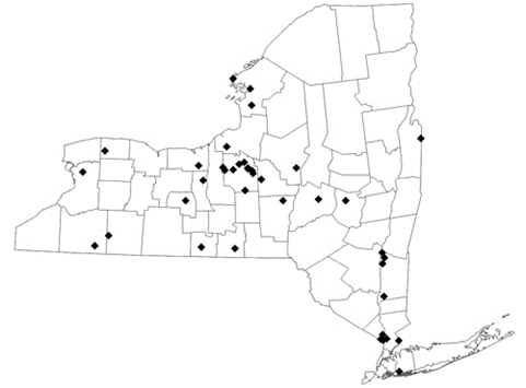
The initial communities inventoried by SWAT were solicited by personnel from Onondaga County Extension, but, as the program became better known through word of mouth, presentations, and Cornell's Community Forestry website, communities began contacting Extension statewide to request SWAT's services. To accommodate additional inventories and ease the travel burden on students, a Hudson River Valley SWAT team associated with Dutchess County Extension and comprised of Master Gardeners was organized in 2006. Forty street tree inventories have been conducted since 2002, with Cornell SWAT responsible for 32, representing approximately one-third of all street tree inventories conducted statewide in that time frame (Figure 1).
Figure 1.
SWAT Inventory Locations in New York State (2002-2010)
SWAT Community Characteristics
Thirty-nine communities have been inventoried by SWAT since 2002; the Village of Red Hook was inventoried twice. Sixty-nine percent of SWAT communities have populations of 5,000 persons or fewer, and the median population is 2,644 persons (2000 U.S. Census). While there is no statistically significant difference (α = .05) between SWAT communities and all New York State Census Places (i.e., villages, cities, and census designated places, n = 1050, 2000 U.S. Census) for such measures as population density, housing unit density, percent urban and rural population, per capita income, educational attainment of at least a bachelor's degree, and median age of population, significant differences do exist for percent vacant and occupied housing units, median household income, percent owner occupancy, median value of owner occupied units, and median year structure built (Table 1).
These differences indicate that SWAT communities are characterized by lower median household incomes, lower percentages of owner occupancy as compared to rentals, lower values for owner occupied housing units, older structures, and higher housing unit occupancy rates relative to communities throughout New York State. They are the types of communities initially targeted by the work team, those least likely to have the resources to employ an urban forester or to hire a commercial firm to inventory street trees and develop a community forest management plan.
| SWAT | All NYS | Uneq. var t | p(same) | |
| Housing Unit Density | 1070.8 | 933.15 | 1.0328 | 0.3088 |
| Median Age | 38.394 | 38.036 | 0.4367 | 0.6649 |
| Median Household Income | 42724 | 53831 | -3.6702 | 0.0007 |
| Median Value Owner Occupied Housing | 123050 | 171820 | -3.0827 | 0.0037 |
| Median Year Structure Built | 1947 | 1952 | -3.1435 | 0.0035 |
| Per Capital Income | 23627 | 25700 | -1.1389 | 0.2622 |
| Percent Housing Units Occupied | 93.20 | 90.27 | 4.4466 | 0.0000 |
| Percent Minimum Bachelor's Degree | 31.13 | 27.94 | 1.1914 | 0.2416 |
| Percent Owner Occupancy | 56.64 | 63.95 | -3.0951 | 0.0038 |
| Percent Rural Population | 26.12 | 30.70 | -0.5672 | 0.5746 |
| Population | 4801 | 14620 | -1.2738 | 0.2030 |
| Population Density | 2482.9 | 2370.3 | 0.3067 | 0.7609 |
SWAT Data Collection Methodology
Data collection methods have focused from the start on meeting the needs of community forest managers while also taking into account the capabilities of the students conducting the inventories, and, since funds to run the program are limited, the need for a low-cost equipment and software buy-in. In addition, because any street tree inventory is a snapshot in time, another consideration has been to use methods that can be replicated by inventoried communities to update the data conducted by SWAT.
Data Fields
The emphasis in data collected by SWAT is to provide information most useful to community forest managers. This includes, first, the species composition and age of trees to facilitate sustainable long-term management and, second, the condition of trees and their street location to enable persons responsible for maintenance to prioritize those activities and get back to each tree (Table 2). Students do not make hazard evaluations or suggest trees for removal because they are not trained to make these calls and such calls can lead to liability claims. They are asked instead to assess whether a tree is a "consult," meaning does it reflect a combination of poor condition and significant size to warrant inspection by an experienced arborist. Students work in teams of two and are expected to inventory roughly 30 trees and/or planting spaces per hour. This rate compares favorably with rates reported by Buchanan (1991), Bloniarz and Ryan (1996), and Cozad, McPherson, and Harding (2005), although it may vary due to street type (gridded or cul-de-sac), land use (residential or commercial), and density (compact or sprawl).
| Address Number, Street Name, and On Street: For all trees and planting spaces, established primarily by tax parcel address. |
|
GPS: Latitude (Y) and Longitude (X) coordinates for trees and planting spaces. |
| Location Type: Placement of trees and planting spaces assessed by one of five ratings: 1= front yard or lawn; 2 = treelawn planting strip less than four feet wide; 3 = treelawn planting strip greater than four feet wide; 4 = sidewalk tree pit; 5 = street median. |
| Species: Trees identified and assigned their respective botanical names. |
| DBH: Trunk diameter at breast height (approximately 4.5 feet above the ground) measured to the nearest inch. |
| Condition Wood: The health of a tree's wood (its structural health) assessed by one of four ratings: 1= Dead or Dying – extreme problems; 2 = Poor – major problems; 3 = Fair – minor problems; 4 = Good – no apparent problems. |
| Condition Leaves: The health of a tree's leaves (its functional health) assessed by one of four ratings: 1= Dead or Dying – extreme problems; 2 = Poor – major problems; 3 = Fair – minor problems; 4 = Good – no apparent problems. |
| Percent Deadwood: The percentage of deadwood in the tree canopy assessed by one of five ratings: 1= less than 10%; 2 = 10 – 25%; 3 = 25 – 50%; 4 = 50 – 75%; 5 = greater than 75%. |
| Maintenance Recommendation: Tree maintenance needs assessed by one of four ratings: 1= None – no maintenance necessary; 2 = Train – routine maintenance for a young tree; 3 = Routine Prune – routine maintenance of a mature tree; 4 = High Priority Prune – a tree requiring immediate maintenance. |
| Consult: Based on the condition of the tree, should a certified arborist should be brought in to examine the tree: 1 = No; 2 = Yes. |
| Sidewalk Damage: The presence or absence of damage associated with tree roots where the sidewalk is heaved at least ¾ inch: 1 = No; 2 = Yes. |
| Wire Conflict: The presence or absence of single or triple phase overhead utility wires: 1 = No; 2 = Yes. |
Equipment and Software
Data is collected in walking surveys using Pharos Traveler 535 PDA (personal digital assistant) handheld computers running U.S. Forest Service i-Tree software available free of charge. GPS (Global Positioning System) coordinates are also collected for each tree and planting space using Garmin 60CSx series receivers typically accurate from 3 to 5 meters. Coordinates are brought into GIS (Geographic Information System) and rectified post-inventory to aerial orthoimagery. These corrected coordinates become the basis for maps, GIS shapefiles, and Google Earth kml files given to inventoried communities as part of data analysis and management recommendations. An Excel file of inventory data is also provided as well as a data collection template for collecting updated data subsequent to the inventory.
Data Accuracy
Errors in data collection occur in all street tree inventories whether conducted by professionals or non-professionals. They are of particular concern in inventories conducted by students or community volunteers because the benefits of a student or volunteer based inventory (e.g., lower costs, community involvement) must be weighed against the accuracy of a professionally conducted inventory. Bloniarz and Ryan (1996) reported for a Brookline, MA inventory conducted by community volunteers that agreement between volunteers and certified arborists was 91% for the genus and 80% for the genus and species of inventoried trees. Cozad et al. (2005) reported 80% agreement for genus and species between volunteers and professionals in a Minneapolis, MN inventory.
Students participating in SWAT are undergraduates and graduates who have taken courses in tree species identification and excelled in that coursework. In addition, all students attend a half-day training session in the fall prior to that year's first inventory in which they receive instruction in inventory methodology and hands-on practice with PDAs and GPS units taking data in nearby streets (master gardeners in the Hudson Valley SWAT receive similar training). Accuracy of SWAT data has been found to be at least on par with error rates found in Bloniarz and Ryan (1996) and Cozad et al. (2005), although, as mentioned above, errors inevitably occur. In addition, just as Cozad et al. (2005) found a "fair amount of variability" between volunteer teams, data accuracy varies between SWAT teams and is best explained by level of experience. Students who have participated in SWAT in a previous year tend to be quicker and more accurate than students doing SWAT for the first time. Therefore, it is standard practice to pair up, if possible, a student who is experienced with one who is not.
Data Analysis and Management Recommendations
An analysis of inventory data is performed following the completion of data collection, data scrubbing, and ground-truthing. This analysis focuses on species and DBH (trunk diameter at breast height) distributions. Species distribution is of great importance given the historic devastation to American Elms caused by Dutch elm disease and current threats posed by invasive pest species such as the Emerald Ash Borer and Asian Longhorned Beetle. Greater species diversity fosters increased resilience to invasive pests and blights. Based on the species distribution analysis, communities are able to make informed decisions about new plantings and maintain or increase species diversity. An analysis of DBH distribution is also essential because it reveals whether sufficient young trees are being planted to compensate for tree mortality and the extent to which communities need to focus resources on new plantings.
Analyses of species and DBH distributions are accompanied by an analysis of tree condition both for the tree population as a whole and for the most prevalent species. The latter is especially helpful in identifying areas of special concern. In New York State, for example, large, old Sugar Maples (Acer saccharum) in poor condition are frequently common. Knowledge of such situations enables communities to identify pressing maintenance needs and make informed decisions in allocating resources.
Finally, ecosystem and other benefits provided by community trees are calculated using U.S. Forest Service i-Tree Streets software. SWAT emphasizes to inventoried communities that street trees should be valued not simply for aesthetic reasons, but also for the ecosystem benefits they provide, such as CO2 reduction, energy conservation, and stormwater control. It is hoped that greater awareness of these benefits will encourage communities to maintain if not increase budgets for street tree management and promote a sustainable community forest.
These analyses form the basis of management recommendations made by SWAT to each inventoried community. The recommendations are included in a report given at a presentation made by SWAT a few months after the inventory to local officials such as village trustees, DPW heads, and Shade Tree Board members. Extension personnel are also encouraged to attend. The involvement of Extension personnel throughout the inventory process, whether fielding the initial community contact, taking part in the inventory, or attending the presentation, is helpful in creating long-term working relationships with inventoried communities extending beyond data collection to sustainable community forest management and planning. Similarly, SWAT stresses to inventoried communities that it remains a resource ready to assist them post-inventory should they require more help or additional information.
Program Impact
Questionnaires have been given periodically to communities inventoried by SWAT to gauge the program's impact and find areas for improvement. Responses to these questionnaires have stated consistently that obtaining a street tree inventory has resulted in the creation of a community forestry management plan and increased appreciation for community trees by residents, elected officials, and even the personnel responsible for street tree maintenance. More specifically, communities have reported increased funding for street tree programs, greater diversity in new tree plantings, more proactive pruning and maintenance, and improved volunteer participation in community plantings and Arbor Day celebrations. The primary problem described by inventoried communities has been in maintaining and updating their data post-inventory.
Students conducting the inventories have likewise been given questionnaires asking for suggestions on how to improve the process and what participation in SWAT has meant to them. Suggestions for improvement have been helpful, and many have been implemented. With respect to their participation, while many students stated that conducting the inventories had given them greater confidence in their tree identification skills, at least as many valued working as a team to perform a community service, interacting with community residents and learning about their concerns, and seeing firsthand how street trees are planted and maintained. Therefore, for these students, the SWAT experience has not only complemented their classroom instruction, but also given it a situated, real world context, bridging the gap between learning and use (Brown, Collins, & Duguid, 1989) and enriching their education.
Finally, SWAT inventory data and methods have been used in the battle being waged against invasive pest species in New York State. SWAT data has been collated with other inventory data collected statewide to enable Extension and the Department of Environmental Conservation to better understand and budget for New York State's vulnerability to the Emerald Ash Borer and Asian Longhorned Beetle. SWAT inventory methods have been recommended by Extension to communities and grassroots organizations looking to conduct either a complete street tree inventory or one specifically targeting ash trees. A powerpoint describing SWAT methods and explaining the value of conducting an inventory has been included by Extension in their outreach educational materials.
SWAT as a Model for Land-Grant Institutions
Cornell University, founded in 1865, is New York State's land-grant institution. SWAT was envisioned from its start to be part of Cornell's land-grant mission and partner with Extension to translate university-based knowledge into real-life, practical benefits for New York State communities. As the number of people living and working in cities, villages, and suburbs continues to increase, the role to be played by urban and community forestry has assumed greater importance, and SWAT has sought to facilitate community forestry in smaller communities in New York State. Nevertheless, despite the 40 inventories conducted by SWAT since 2002 and the efforts made by other communities in the New York State to inventory their street trees, the majority of communities in New York State, and particularly communities with smaller populations, do not have street tree inventories and lack community forestry management plans.
It can be assumed based on the few studies that have been done (Bernhardt & Swiecki, 1993; Reeder & Gerhold, 1993) that the relative lack of inventories for New York State communities applies to most if not all other states. Therefore, getting street trees inventoried, and especially street trees in communities with smaller populations, is a real and pressing need not merely for New York State, but for other states as well.
There are more than 100 land-grant institutions in the United States. Many of these institutions have horticulture and/or landscape architecture departments offering courses on woody plant identification, some have urban forestry programs, and many are associated with Extension systems that train Master Gardeners. An opportunity exists, therefore, in many states to partner land-grant institutions with Extension systems to train students and Master Gardeners to conduct street tree inventories. This has been done in several instances (Weisman, 2009; Prochaska & Hoffman, 2010), but, as important as these efforts have been, they have not involved a systematic, sustainable, or statewide approach. SWAT provides such an approach and, with methods that can be easily replicated and a record of success, could serve as a model for land-grant institutions and Extension systems looking to inventory street trees.
Conclusions
Since the program's founding in 2002, SWAT has conducted 40 street tree inventories for communities in New York State that likely would not have been inventoried otherwise. Because a street tree inventory provides the basis for community forestry planning, SWAT has made an important contribution to the health and sustainability of community trees not just for inventoried communities, but also, given the program's geographic breadth and the large number of communities surveyed, for New York State as a whole. With the growing number of environmental challenges facing communities of all sizes, the value of benefits provided by trees will only increase in significance. So, too, will the role to be played by SWAT and any programs modeled after it in protecting the short- and long-term health of street trees and the community forest resource.
References
Bernhardt, E., & Swiecki, T. J. (1993). The state of urban forestry in Califomia—1992. California Department of Forestry and Fire Prevention, Urban Forestry Program. 61 pp. Retrieved from: http://www.ufei.org/files/pubs/SUF92.pdf
Bloniarz, D. V., & Ryan, D. P. (1996). The use of volunteer initiatives in conducting urban forest resource inventories, Journal of Arboriculture, 22(2), 75-82.
Broussard, S. R., & Jones, S. B. (2001). Extension, communities, and schools: Results of a collaborative forestry education project in Philadelphia. Journal of Extension [On-line], 39(3) Article 3FEA5. Available at: https://www.joe.org/joe/2001june/a5.php
Brown, J. S., Collins, A., & Duguid, P. (1989). Situated cognition and the culture of learning. Educational Researcher, 18(1), 32-42.
Cozad, S., McPherson, E. G., & Harding, J. A. (2005). STRATUM case study evaluation in Minneapolis, Minnesota. Retrieved from: http://www.itreetools.org/resources/reports/Minneapolis%20Case%20Study.pdf .
Dwyer, J. F., McPherson, E. G., Schroeder, H. W., & Rowntree, R. A. (1992). Assessing the benefits and costs of the urban forest. Journal of Arboriculture, 18(5), 227-234.
Escobedo, F., & Andreu, M. (2008). A community guide to urban forest Inventories. Florida Cooperative Extension, FOR 173. Retrieved from: http://edis.ifas.ufl.edu/fr232
Fehlis, C. P. (1992). Urban Extension programs. Journal of Extension [On-line], 30(2) Article 2FEA3. Available at: https://www.joe.org/joe/1992summer/a3.php
Hughes, G., Measells, M. K., Grado, S. C., Dunn, M. A., Idassi, J. O., & Zielinski, R. J. (2005). Underserved forest landowner workshops: Opportunities for landowners and Extension. Journal of Extension [On-line], 43(4) Article 4FEA5. Available at: https://www.joe.org/joe/2005august/a5.php
Iles, J. (1999). Community trees: Establishing a community tree program. Iowa State University, Pm-1429a. Retrieved from: http://www.extension.iastate.edu/Publications/PM1429a.pdf
Maco, S. E., & McPherson, E. G. (2003). A practical approach to assessing structure, function, and value of street tree populations in small communities. Journal of Arboriculture, 29(2), 84-97.
McGill, D. W., Campbell, L. G., & Pierskalla, C. (2007). The role of the West Virginia Extension Service in forestry education and technical assistance. Journal of Extension [On-line], 45(6) Article 6RIB6. Available at: https://www.joe.org/joe/2007december/rb6.php
Pollock, C. (2010). Fight back against emerald ash borer; Inventory community trees. Ohio State University Extension. Retrieved from: http://extension.osu.edu/news-releases/fight-back-against-emerald-ash-borer-inventory-community-trees.
Prochaska, S. C., & Hoffman, M. (2010). Street Tree Resource Evaluation and Education Trust (STREET). Journal of Extension [On-line], 48(4) Article 4RIB5. Available at: https://www.joe.org/joe/2010august/rb5.php
Reeder, E. C., & Gerhold, H. D. (1993). Municipal tree programs in Pennsylvania. Journal of Arboriculture, 19(1), 12-19.
Skelton, P., & Josiah, S. J. (2003). Improving urban tree care in the Great Plains: Impacts of the Nebraska tree care workshops. Journal of Extension [On-line], 41(4) Article 4RIB4. Available at: https://www.joe.org/joe/2003august/rb4.php
Tate, R. L. (1985). Uses of street tree inventory data. Journal of Arboriculture, 11(7), 210-213.
Weisman, P. E. (2009). Urban forestry students assist Radford, Virginia, with street tree assessment. Engagement Matters, 1(5), 2-3. Retrieved from: http://www.cnr.vt.edu/cnr_pdf/EngagementMatters-may09.pdf